


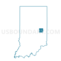
LIBERTY 02, Henry County, Indiana
About
Outline

Summary
| Unique Area Identifier | 577778 |
| Name | LIBERTY 02 |
| County | Henry County |
| State | Indiana |
| Area (square miles) | 19.28 |
| Land Area (square miles) | 19.26 |
| Water Area (square miles) | 0.02 |
| % of Land Area | 99.88 |
| % of Water Area | 0.12 |
| Latitude of the Internal Point | 39.91190160 |
| Longtitude of the Internal Point | -85.30050990 |
Maps


Graphs
Select a template below for downloading or customizing gragh for LIBERTY 02, Henry County, Indiana


Neighbors
Neighoring Voting District (by Name) Neighboring Voting District on the Map
- BLUE RIVER, Henry County, IN
- DUDLEY, Henry County, IN
- FRANKLIN, Henry County, IN
- HENRY 18, Henry County, IN
- LIBERTY 01, Henry County, IN
- PRAIRIE 03, Henry County, IN
Top 10 Neighboring County Subdivision (by Population) Neighboring County Subdivision on the Map
- Henry township, Henry County, IN (22,560)
- Prairie township, Henry County, IN (5,517)
- Liberty township, Henry County, IN (1,455)
- Blue River township, Henry County, IN (1,224)
- Franklin township, Henry County, IN (1,157)
- Dudley township, Henry County, IN (1,041)
Top 10 Neighboring Unified School District (by Population) Neighboring Unified School District on the Map
- New Castle Community School Corporation, IN (23,336)
- Nettle Creek School Corporation, IN (7,123)
- Blue River Valley Schools, IN (6,739)
- South Henry School Corporation, IN (4,477)